Road stops in Caracas, Distrito Federal, Venezuela
RoadBreakMap lists 182 mapped road stops in Caracas, Distrito Federal, Venezuela: fuel, EV chargers, rest areas, drive-throughs and public toilets, where the data has them. Data: OpenStreetMap and Open Charge Map.
About Caracas
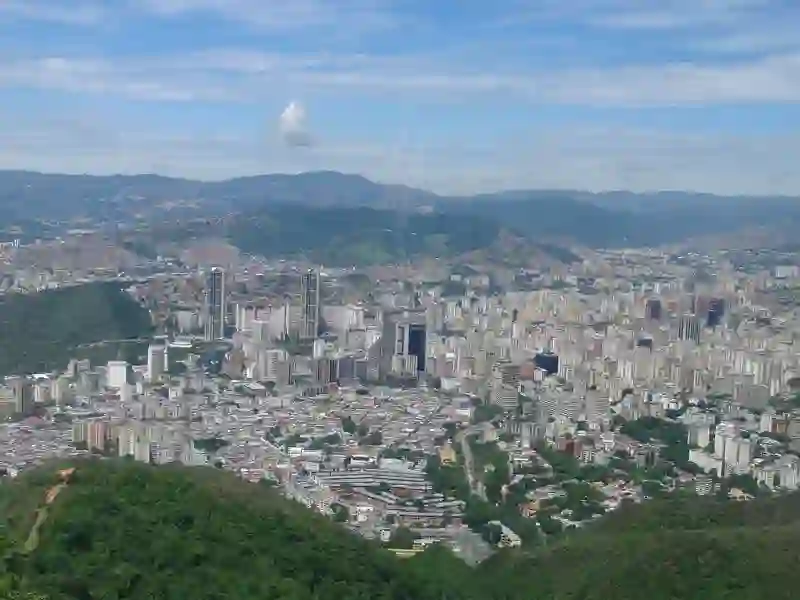
Caracas is the capital and largest city of Venezuela, located in the Libertador Municipality along the Guaire River. It sits in the Caracas Valley within the Venezuelan coastal mountain range. The city has a population of over 2 million and is known for its service-based economy, with businesses including banks and malls. Caracas is also recognized as Venezuela's cultural capital, home to theaters, museums, and some of the tallest skyscrapers in Latin America.
Source: Wikipedia (CC BY-SA 4.0) and Wikidata, rewritten for RoadBreakMap.
Fuel (81)Rest areas (51)Drive-throughs (37)
Places
Listed with the most recorded facilities first. This is not a rating or a recommendation; always check before you travel.
- E/S Atlas (SUB)
- Open 24 hours
- Wheelchair access
- E/S Altamira
- Open 24 hours
- Wheelchair access
- E/S Avilago
- Open 24 hours
- Wheelchair access
- E/S Baralt
- Open 24 hours
- Wheelchair access
- E/S Ciudad Universitaria
- Open 24 hours
- Wheelchair access
- E/S Country Club
- Open 24 hours
- Wheelchair access
- E/S Guayana
- Open 24 hours
- Wheelchair access
- E/S La Católica
- Open 24 hours
- Wheelchair access
- E/S La Estancia (GAS)
- Open 24 hours
- Wheelchair access
- E/S Las Américas (SUB)
- Open 24 hours
- Wheelchair access
- E/S Las Mercedes
- Open 24 hours
- Wheelchair access
- E/S Miguelangel
- Open 24 hours
- Wheelchair access
- E/S Paraíso
- Open 24 hours
- Wheelchair access
- E/S Santa Monica
- Open 24 hours
- Wheelchair access
- E/S Sucre 37 (SUB)
- Open 24 hours
- Wheelchair access
- E/S Tamanaco
- Open 24 hours
- Wheelchair access
- E/S Victoria (SUB)
- Open 24 hours
- Wheelchair access
- E/S Ávila
- Open 24 hours
- Wheelchair access
- Farmatodo
- Open 24 hours
- Wheelchair access
- Farmatodo
- Open 24 hours
- Wheelchair access
- Farmatodo
- Open 24 hours
- Wheelchair access
- Farmatodo
- Open 24 hours
- Wheelchair access
- Punto de Recarga Estacionamiento del CCCT
- Open 24 hours
- Free
- EV charging
- Punto de Recarga Estacionamiento del CCCT
- Open 24 hours
- Free
- EV charging
- Punto de Recarga Estacionamiento del Centro Médico
- Open 24 hours
- Free
- EV charging
- Banco Nacional de Crédito
- Opening hours listed
- Wheelchair access
- E/S 9 de Diciembre (SUB)
- Wheelchair access
- E/S El Peaje
- Opening hours listed
- Wheelchair access
- E/S El Triángulo (SUB)
- Opening hours listed
- Wheelchair access
- E/S Garage El Puente (SUB)
- Opening hours listed
- Wheelchair access
- E/S Garage de Los Flores
- Opening hours listed
- Wheelchair access
- E/S La Gran Estación (Solo Transporte)
- Wheelchair access
- E/S La Laguna (SUB)
- Opening hours listed
- Wheelchair access
- E/S La Natividad (SUB)
- Opening hours listed
- Wheelchair access
- E/S La Paz (Transporte)
- Opening hours listed
- Wheelchair access
- E/S La Popular
- Wheelchair access
- E/S La Vialidad (Transporte)
- Wheelchair access
- E/S Lago Expresa El Paraíso (SUB)
- Opening hours listed
- Wheelchair access
- E/S Puente Hierro (Solo GAS)
- Opening hours listed
- Wheelchair access
- Estación de Servicios La Católica
- Open 24 hours
- Wheelchair access
- Farmatodo
- Opening hours listed
- Wheelchair access
- Farmatodo
- Opening hours listed
- Wheelchair access
- Farmatodo
- Opening hours listed
- Wheelchair access
- Farmatodo
- Opening hours listed
- Wheelchair access
- Farmatodo
- Open 24 hours
- Wheelchair access
- McDonald's
- Opening hours listed
- Wheelchair access
- McDonald's
- Opening hours listed
- Wheelchair access
- McDonald's
- Opening hours listed
- Wheelchair access
- McDonald's
- Opening hours listed
- Wheelchair access
- McDonald's
- Opening hours listed
- Wheelchair access
- McDonald's
- Opening hours listed
- Wheelchair access
- McDonald's
- Opening hours listed
- Wheelchair access
- McDonald's
- Opening hours listed
- Wheelchair access
- McDonald's
- Opening hours listed
- Wheelchair access
- Punto de Recarga Barako Restaurant
- Opening hours listed
- Free
- EV charging
- Punto de Recarga Centro Comercial Santa Fe
- Opening hours listed
- Free
- EV charging
- Punto de Recarga Restaurante Caracas Meat
- Opening hours listed
- Free
- EV charging
- Punto de Recarga Universidad Católica Andrés Bello
- Opening hours listed
- Free
- EV charging
- Arturo's
- Opening hours listed
- Wheelchair access
- Avenida José Antonio Páez
- Opening hours listed
Showing 60 of 182. See more on the map
Nearby: Baruta Petare Catia La Mar Los Teques La Victoria Guatire Cagua Maracay Palo Negro San Juan de los Morros Guacara Valencia
Places, opening hours and charger details come from open data and may be incomplete, out of date or wrong. Never use your phone while driving. Disclaimer & terms