Road stops in State College, Pennsylvania, the United States
RoadBreakMap lists 270 mapped road stops in State College, Pennsylvania, the United States: fuel, EV chargers, rest areas, drive-throughs and public toilets, where the data has them. Data: OpenStreetMap and Open Charge Map.
About State College
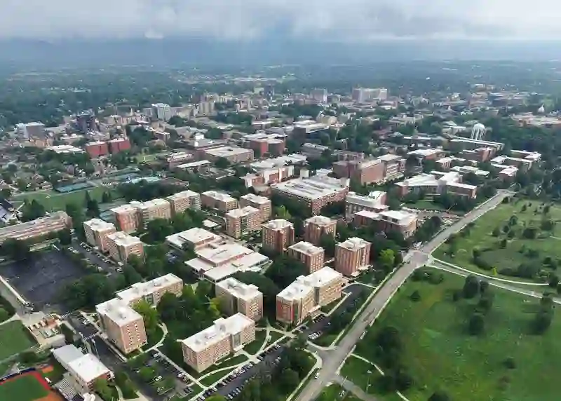
State College is a borough in Centre County, Pennsylvania, known for being home to the main campus of Pennsylvania State University. Established in 1896, it has grown significantly over the years and is recognized as the largest borough in the state. The area is often referred to as Happy Valley, reflecting its resilient economy. State College features several cultural institutions, including the Palmer Museum of Art and the Bryce Jordan Center. The borough is well-connected, with public transport provided by the Centre Area Transportation Authority and the State College Regional Airport linking to larger airline hubs.
Source: Wikipedia (CC BY-SA 4.0) and Wikidata, rewritten for RoadBreakMap.
Public toilets (90)Drive-throughs (72)Fuel (61)EV chargers (42)
Places
Listed with the most recorded facilities first. This is not a rating or a recommendation; always check before you travel.
- Sheetz
- Open 24 hours
- Tesla Supercharger
- Open 24 hours
- Fee applies
- Fast EV (250 kW)
- Tesla Supercharger
- Open 24 hours
- Fee applies
- Fast EV (150 kW)
- Rutter's
- Open 24 hours
- Sheetz
- Open 24 hours
- Wheelchair access
- Public toilets
- Wheelchair access
- Free
- Burger King
- Opening hours listed
- Wheelchair access
- M&T Bank
- Opening hours listed
- Wheelchair access
- Nittany Minit Mart
- Open 24 hours
- Rite Aid
- Opening hours listed
- Wheelchair access
- Sheetz
- Open 24 hours
- Sheetz
- Open 24 hours
- Sheetz
- Open 24 hours
- Sheetz
- Opening hours listed
- Starbucks
- Opening hours listed
- Public toilets
- Free
- Public toilets
- Wheelchair access
- Free
- Public toilets
- Wheelchair access
- Free
- Public toilets
- Wheelchair access
- Free
- Arby's
- Opening hours listed
- Bathhouse
- Wheelchair access
- Baby change
- Boalsburg Apothecary
- Opening hours listed
- Wheelchair access
- Burger King
- Opening hours listed
- CVS Pharmacy
- Opening hours listed
- Chase
- Opening hours listed
- Chick-fil-A
- Opening hours listed
- DQ Grill & Chill
- Opening hours listed
- Dunkin'
- Opening hours listed
- Dunkin'
- Opening hours listed
- Dunkin'
- Opening hours listed
- Dunkin'
- Opening hours listed
- Dunkin'
- Opening hours listed
- Dunkin'
- Opening hours listed
- Exxon
- Opening hours listed
- Exxon
- Opening hours listed
- First Commonwealth Bank
- Opening hours listed
- First National Bank
- Opening hours listed
- First National Bank
- Opening hours listed
- Fulton Bank
- Opening hours listed
- GIANT Gasoline
- Opening hours listed
- Giant
- Opening hours listed
- Jersey Mike's Subs
- Opening hours listed
- KFC
- Opening hours listed
- Kish Bank
- Opening hours listed
- M&T Bank
- Opening hours listed
- M&T Bank
- Opening hours listed
- McDonald's
- Opening hours listed
- McDonald's
- Opening hours listed
- McDonald's
- Opening hours listed
- McDonald's
- Opening hours listed
- PNC Bank
- Opening hours listed
- Pacific Pride
- State College, PA Supercharger
- Sunoco
- Sunoco
- Opening hours listed
- Taco Bell
- Opening hours listed
- Wendy's
- Opening hours listed
- Public toilets
- Free
- Public toilets
- Free
- Public toilets
- Wheelchair access
Showing 60 of 270. See more on the map
Nearby: Lewistown Lamar Lock Haven Altoona Clearfield Penfield Carlisle Chambersburg Breezewood Williamsport Saint Marys Coudersport
Places, opening hours and charger details come from open data and may be incomplete, out of date or wrong. Never use your phone while driving. Disclaimer & terms