Road stops in Chambersburg, Pennsylvania, the United States
RoadBreakMap lists 153 mapped road stops in Chambersburg, Pennsylvania, the United States: fuel, EV chargers, rest areas, drive-throughs and public toilets, where the data has them. Data: OpenStreetMap and Open Charge Map.
About Chambersburg
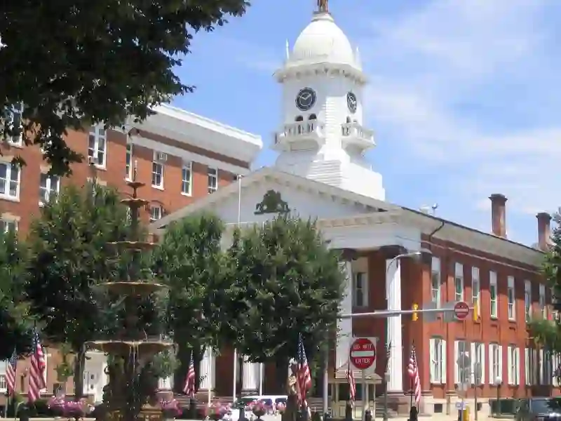
Chambersburg is a borough in Franklin County, Pennsylvania, and serves as the county seat. It is located in the Cumberland Valley, 13 miles north of Maryland. Established in 1734, Chambersburg has a population of 21,903 as of 2020. The town developed around water mills on Conococheague Creek and Falling Spring Creek. It has a history tied to significant events, including the Civil War, when it was burned by Confederate forces. Chambersburg is accessible via the Lincoln Highway, U.S. 30, and Interstate 81, and it has a mix of flatter and mountainous terrain.
Source: Wikipedia (CC BY-SA 4.0) and Wikidata, rewritten for RoadBreakMap.
Fuel (43)Drive-throughs (41)EV chargers (38)Public toilets (30)
Places
Listed with the most recorded facilities first. This is not a rating or a recommendation; always check before you travel.
- Tesla Supercharger
- Open 24 hours
- Wheelchair access
- Fee applies
- Fast EV (50 kW)
- Tesla Supercharger
- Open 24 hours
- Fee applies
- Fast EV (250 kW)
- Tesla Supercharger
- Open 24 hours
- Fee applies
- Fast EV (50 kW)
- EV chargers
- Open 24 hours
- Free
- EV chargers
- Open 24 hours
- Free
- EV up to 3.7 kW
- McDonald's
- Opening hours listed
- Wheelchair access
- Sheetz
- Open 24 hours
- Sheetz
- Open 24 hours
- Sheetz
- Open 24 hours
- Sheetz
- Sheetz
- Turkey Hill
- Open 24 hours
- Public toilets
- Wheelchair access
- Baby change
- Public toilets
- Wheelchair access
- Baby change
- Arby's
- Opening hours listed
- Arby's
- Opening hours listed
- BJ's Gas
- Burger King
- Opening hours listed
- Burger King
- Opening hours listed
- CVS Pharmacy
- Opening hours listed
- Chick-fil-A
- Opening hours listed
- Chick-fil-A
- Opening hours listed
- DQ Grill & Chill
- Opening hours listed
- Dunkin'
- Opening hours listed
- Electrify America
- Giant
- Opening hours listed
- Giant
- Opening hours listed
- Hardee's
- Opening hours listed
- KFC
- Opening hours listed
- Little Caesars
- Opening hours listed
- M&T Bank
- Opening hours listed
- M&T Bank
- McDonald's
- Opening hours listed
- McDonald's
- Opening hours listed
- McDonald's
- Opening hours listed
- Orrstown Bank
- Opening hours listed
- Panera Bread
- Opening hours listed
- Popeyes
- Opening hours listed
- Privy
- Privy
- Sheetz
- Sheetz
- Sunoco
- Opening hours listed
- Taco Bell
- Opening hours listed
- Tobacco Hut
- Opening hours listed
- Wendy's
- Opening hours listed
- Public toilets
- Wheelchair access
- ACNB Bank
- Opening hours listed
- ACNB Bank
- Opening hours listed
- AER AER CV RAILT1
- EV up to 3.7 kW
- AER HICKORY BRIDGE
- EV up to 3.7 kW
- AER LIBERTY RESORT1
- EV up to 3.7 kW
- AER LIBERTY RESORT2
- EV up to 3.7 kW
- Ayr Town Center
- EV up to 3.7 kW
- Blue Mountain Service Plaza
- Chambersburg Crossing
- EV up to 3.7 kW
- Chambersburg Hyundai
- Fast EV (50 kW)
- Chambersburg Square
- Fast EV (50 kW)
- Citgo
- Computer Tutor
- EV up to 3.7 kW
Showing 60 of 153. See more on the map
Nearby: Hagerstown Westminster Frederick Hanover Carlisle Martinsburg Breezewood Ballenger Creek Lewistown Leesburg Everett Ashburn
Places, opening hours and charger details come from open data and may be incomplete, out of date or wrong. Never use your phone while driving. Disclaimer & terms