Road stops in Hagerstown, Maryland, the United States
RoadBreakMap lists 218 mapped road stops in Hagerstown, Maryland, the United States: fuel, EV chargers, rest areas, drive-throughs and public toilets, where the data has them. Data: OpenStreetMap and Open Charge Map.
About Hagerstown
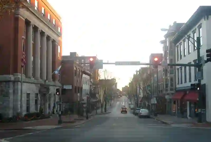
Hagerstown is a city located in Washington County, Maryland, and serves as the county seat. With a population of 43,527 as of 2020, it is the most populous city in the Maryland Panhandle. The city has a unique topography shaped by stone ridges and is known for its older buildings made from local limestone. Hagerstown is a center of transit and commerce, connected by major interstates and railroads, and is a hub for a larger tri-state area.
Source: Wikipedia (CC BY-SA 4.0) and Wikidata, rewritten for RoadBreakMap.
Fuel (69)Public toilets (52)Drive-throughs (45)EV chargers (44)
Places
Listed with the most recorded facilities first. This is not a rating or a recommendation; always check before you travel.
- DC Corridor Hagerstown #1
- Open 24 hours
- Fee applies
- Fast EV (50 kW)
- Tesla Supercharger
- Open 24 hours
- Fee applies
- Fast EV (150 kW)
- Tesla Supercharger
- Open 24 hours
- Fee applies
- Fast EV (250 kW)
- Public toilets
- Open 24 hours
- Free
- Public toilets
- Open 24 hours
- Free
- I-81 Southbound West Virginia Welcome Center
- Open 24 hours
- Rutter's
- Open 24 hours
- South Mountain Restrooms
- Open 24 hours
- Wheelchair access
- Public toilets
- Open 24 hours
- Baby change
- Free
- Public toilets
- Open 24 hours
- Free
- Public toilets
- Open 24 hours
- Free
- AC&T
- Open 24 hours
- Burger King
- Opening hours listed
- Dunkin' Donuts
- Opening hours listed
- Wheelchair access
- McDonald's
- Open 24 hours
- Roy Rogers
- Opening hours listed
- Wheelchair access
- Sheetz
- Open 24 hours
- Sheetz
- Open 24 hours
- Sheetz
- Open 24 hours
- Sheetz
- Open 24 hours
- Sheetz
- Open 24 hours
- Sheetz
- Open 24 hours
- Sheetz
- Opening hours listed
- Sheetz
- Opening hours listed
- Wendy's
- Open 24 hours
- eVgo
- Open 24 hours
- Fast EV (50 kW)
- Public toilets
- Free
- Arby's
- Opening hours listed
- Arby's
- Opening hours listed
- Burger King
- Opening hours listed
- Burger King
- Opening hours listed
- Burger King
- Opening hours listed
- ChargePoint
- EV up to 3.7 kW
- ChargePoint
- EV up to 3.7 kW
- ChargePoint
- EV up to 3.7 kW
- Chick-fil-A
- Opening hours listed
- Dunkin'
- Opening hours listed
- Dunkin'
- Opening hours listed
- Dunkin'
- Opening hours listed
- Dunkin' Donuts
- Opening hours listed
- Hardee's
- Opening hours listed
- Love's
- M&T Bank
- Opening hours listed
- McDonald's
- Opening hours listed
- McDonald's
- Opening hours listed
- McDonald's
- Opening hours listed
- McDonald's
- Opening hours listed
- McDonald's
- Opening hours listed
- McDonald's
- Opening hours listed
- McDonald's
- Opening hours listed
- McDonald's
- Opening hours listed
- McDonald's
- Opening hours listed
- Popeyes
- Opening hours listed
- Sheetz
- Sheetz
- Sonic
- Opening hours listed
- Taco Bell
- Opening hours listed
- Tesla Supercharger
- Truist
- Opening hours listed
- Wendy's
- Opening hours listed
Showing 60 of 218. See more on the map
Nearby: Chambersburg Martinsburg Frederick Ballenger Creek Leesburg Westminster Ashburn Hanover Breezewood Winchester Carlisle Everett
Places, opening hours and charger details come from open data and may be incomplete, out of date or wrong. Never use your phone while driving. Disclaimer & terms