Road stops in Chesapeake, Virginia, the United States
RoadBreakMap lists 400 mapped road stops in Chesapeake, Virginia, the United States: fuel, EV chargers, rest areas, drive-throughs and public toilets, where the data has them. Data: OpenStreetMap and Open Charge Map.
About Chesapeake
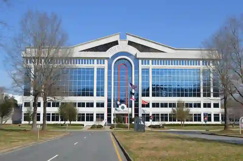
Chesapeake is an independent city in Virginia, part of the Hampton Roads metropolitan area. Established in 1963, it has a diverse landscape that includes urban areas as well as protected farmland, forests, and wetlands. The city is known for its waterfront properties along the Atlantic Intracoastal Waterway and is home to the international headquarters of Dollar Tree. Chesapeake's population was 249,422 in 2020, making it the second-most populous city in Virginia.
Source: Wikipedia (CC BY-SA 4.0) and Wikidata, rewritten for RoadBreakMap.
Fuel (180)Drive-throughs (132)EV chargers (48)Public toilets (35)Diesel (24)
Places
Listed with the most recorded facilities first. This is not a rating or a recommendation; always check before you travel.
- Tesla Supercharger
- Open 24 hours
- Fee applies
- Fast EV (250 kW)
- Tesla Supercharger
- Open 24 hours
- Fee applies
- Fast EV (250 kW)
- Tesla Supercharger
- Open 24 hours
- Fee applies
- Fast EV (250 kW)
- Public toilets
- Open 24 hours
- Wheelchair access
- Baby change
- Free
- 7-Eleven
- Open 24 hours
- Exxon
- Open 24 hours
- Speedway
- Open 24 hours
- Bank of America
- Opening hours listed
- Bathrooms
- Free
- Burger Haven
- Opening hours listed
- Exxon
- Opening hours listed
- McDonald's
- Opening hours listed
- Wheelchair access
- McDonald's
- Opening hours listed
- Wheelchair access
- 7-Eleven
- Opening hours listed
- 7-Eleven
- Opening hours listed
- 7-Eleven
- 7-Eleven
- 7-Eleven
- 76
- Arby's
- Opening hours listed
- Arby's
- Opening hours listed
- Arby's
- Opening hours listed
- Arby's
- Opening hours listed
- Arby's
- Opening hours listed
- Arby's
- Opening hours listed
- Arby's
- Opening hours listed
- Arby's
- Opening hours listed
- Arby's
- Opening hours listed
- BP
- BP
- Bank of America
- Bojangles'
- Opening hours listed
- Burger King
- Opening hours listed
- Burger King
- Opening hours listed
- Burger King
- Opening hours listed
- Burger King
- Opening hours listed
- Burger King
- Opening hours listed
- Burger King
- Opening hours listed
- Burger King
- Opening hours listed
- Burger King
- Opening hours listed
- Burger King
- Opening hours listed
- Burger King
- Opening hours listed
- Burger King
- Opening hours listed
- Burger King
- Opening hours listed
- Burger King
- Opening hours listed
- CITGO
- CVS Pharmacy
- Opening hours listed
- CVS Pharmacy
- Opening hours listed
- Chick-fil-A
- Opening hours listed
- Chick-fil-A
- Opening hours listed
- Chick-fil-A
- Opening hours listed
- Chick-fil-A
- Opening hours listed
- Chick-fil-A
- Opening hours listed
- Chick-fil-A
- Opening hours listed
- Chick-fil-A
- Opening hours listed
- Chick-fil-A
- Opening hours listed
- Chipotle
- Opening hours listed
- Citgo
- Dunkin'
- Opening hours listed
- Dunkin'
- Opening hours listed
Showing 60 of 400. See more on the map
Nearby: Norfolk Virginia Beach Hampton Newport News Suffolk Ahoskie Powells Point Plymouth Kilmarnock Kill Devil Hills Manteo Williamston
Places, opening hours and charger details come from open data and may be incomplete, out of date or wrong. Never use your phone while driving. Disclaimer & terms