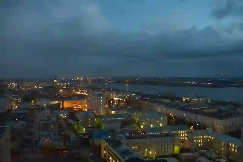
Road stops in Arkhangel’sk, Arkhangelskaya, Russia
RoadBreakMap lists 92 mapped road stops in Arkhangel’sk, Arkhangelskaya, Russia: fuel, EV chargers, rest areas, drive-throughs and public toilets, where the data has them. Data: OpenStreetMap and Open Charge Map.
About Arkhangel’sk
Arkhangel’sk is a city located in the northwest of Russia, along both banks of the Northern Dvina River. It is the largest city and administrative center of Arkhangelsk Oblast. Founded in 1584, it was an important seaport until 1703. The city has a population of around 294,914 and is situated near the White Sea.
Source: Wikipedia (CC BY-SA 4.0) and Wikidata, rewritten for RoadBreakMap.
Fuel (51)Diesel (35)Public toilets (34)
Places
Listed with the most recorded facilities first. This is not a rating or a recommendation; always check before you travel.
- Лукойл
- Open 24 hours
- Wheelchair access
- Лукойл
- Open 24 hours
- Wheelchair access
- Лукойл
- Open 24 hours
- Архнефть
- Open 24 hours
- Лукойл
- Open 24 hours
- Лукойл
- Open 24 hours
- Роснефть
- Open 24 hours
- Роснефть
- Open 24 hours
- Лукойл
- Open 24 hours
- Лукойл
- Open 24 hours
- Лукойл
- Open 24 hours
- Лукойл
- Open 24 hours
- Лукойл
- Open 24 hours
- Лукойл
- Open 24 hours
- Роснефть
- Open 24 hours
- Роснефть
- Open 24 hours
- Роснефть
- Open 24 hours
- Роснефть
- Open 24 hours
- Татнефть
- Open 24 hours
- Татнефть
- Open 24 hours
- Татнефть
- Open 24 hours
- Татнефть
- Open 24 hours
- Татнефть
- Open 24 hours
- Public toilets
- Open 24 hours
- Baby change
- Free
- KFC
- Opening hours listed
- Wheelchair access
- Petroil
- Open 24 hours
- АрхНефть
- Open 24 hours
- Опти
- Open 24 hours
- Северная империя
- Open 24 hours
- Public toilets
- Wheelchair access
- Free
- Avalon
- Opening hours listed
- Petrol
- Open 24 hours
- АГЗС
- Opening hours listed
- АрхНефть
- Open 24 hours
- АрхНефть
- Open 24 hours
- АрхНефть
- Open 24 hours
- АрхангельскОблГаз
- Opening hours listed
- Архангельскоблгаз
- Open 24 hours
- Архангельскоблгаз
- Opening hours listed
- Архнефть
- Open 24 hours
- Дом молодёжи
- Open 24 hours
- Free
- EV charging
- Нефтебизнес
- Open 24 hours
- Норд-ойл
- Open 24 hours
- Опти
- Open 24 hours
- Пункт наполнения газовых баллонов
- Opening hours listed
- Титан Арена
- Opening hours listed
- Free
- EV charging
- Public toilets
- Opening hours listed
- Fee applies
- Public toilets
- Opening hours listed
- Wheelchair access
- Free
- Public toilets
- Opening hours listed
- Wheelchair access
- Free
- АГЗС
- АрхНефть
- Макавто
- Opening hours listed
- Fuel
- Open 24 hours
- Public toilets
- Fee applies
- Public toilets
- Wheelchair access
- Free
- Public toilets
- Opening hours listed
- Public toilets
- Fee applies
- Public toilets
- Opening hours listed
- Fee applies
- Public toilets
- Fee applies
- Public toilets
- Opening hours listed
- Free
Showing 60 of 92. See more on the map
Nearby: Severodvinsk Onega Vel’sk Vologda Cherepovets Danilov Segezha Velikiy Ustyug Kostroma Kotlas Rybinsk Petrozavodsk
Places, opening hours and charger details come from open data and may be incomplete, out of date or wrong. Never use your phone while driving. Disclaimer & terms