Road stops in Doncaster, England, the United Kingdom
RoadBreakMap lists 169 mapped road stops in Doncaster, England, the United Kingdom: fuel, EV chargers, rest areas, drive-throughs and public toilets, where the data has them. Data: OpenStreetMap and Open Charge Map.
About Doncaster
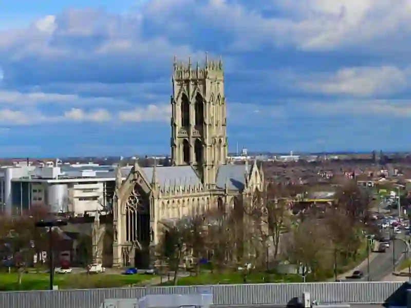
Doncaster is a metropolitan borough in South Yorkshire, England, known for its large area and diverse communities. The borough includes the city of Doncaster along with various towns and villages such as Askern, Bawtry, and Tickhill. Established in 1974, it covers 219 square miles, making it the largest metropolitan borough in England. Doncaster is surrounded by several counties and is part of the Yorkshire and the Humber region, offering a mix of urban and countryside environments.
Source: Wikipedia (CC BY-SA 4.0) and Wikidata, rewritten for RoadBreakMap.
EV chargers (66)Fuel (53)Public toilets (28)Drive-throughs (18)
Places
Listed with the most recorded facilities first. This is not a rating or a recommendation; always check before you travel.
- Doncaster North Motorway Services
- Open 24 hours
- Wheelchair access
- Baby change
- Free
- Shell
- Open 24 hours
- Shell Barnsdale Bar (North)
- Open 24 hours
- Public toilets
- Opening hours listed
- Wheelchair access
- Baby change
- Free
- BP
- Esso
- Opening hours listed
- Gridserve
- Open 24 hours
- EV charging
- Gridserve
- Open 24 hours
- Fast EV (180 kW)
- Gridserve
- Open 24 hours
- Fast EV (50 kW)
- Jet
- Open 24 hours
- Jet
- Open 24 hours
- McDonald's
- Opening hours listed
- Wheelchair access
- McDonald's
- Opening hours listed
- Wheelchair access
- McDonald's
- Open 24 hours
- Wheelchair access
- Morrisons
- Moto Doncaster (North) Services
- Baby change
- Blink
- Fee applies
- EV up to 22 kW
- EV On The Move
- Fee applies
- Fast EV (250 kW)
- Esso
- Open 24 hours
- Lidl
- Fee applies
- Fast EV (50 kW)
- McDonald's
- Open 24 hours
- Ospery
- Fee applies
- EV charging
- Shell
- Open 24 hours
- Shell Barnsdale Bar (South)
- Open 24 hours
- Texaco
- Public toilets
- Wheelchair access
- Free
- Asda
- Asda
- BP Pulse
- EV up to 7 kW
- Esso
- Ionity Doncaster
- Fast EV (350 kW)
- JET
- JET
- JET
- JET
- McDonald's
- Opening hours listed
- McDonald's
- Opening hours listed
- McDonald's
- Opening hours listed
- McDonald's
- Opening hours listed
- McDonald's
- Opening hours listed
- Pace
- Starbucks
- Opening hours listed
- EV chargers
- Fee applies
- Fast EV (120 kW)
- EV chargers
- Fee applies
- Fast EV (50 kW)
- Fuel
- Public toilets
- Wheelchair access
- Free
- Public toilets
- Wheelchair access
- Free
- Public toilets
- Wheelchair access
- Free
- Public toilets
- Wheelchair access
- Free
- Public toilets
- Opening hours listed
- Free
- Adwick Station Park and Ride 1
- EV up to 22 kW
- Aldi-Thorne
- EV up to 7 kW
- Applegreen
- Applegreen
- Argo Drive
- Fast EV (120 kW)
- Arnold Clarke
- Fast EV (150 kW)
- Asda
- Askern Leisure Centre, Doncaster 1
- EV up to 22 kW
- BP
- Barnsdale Bar Services Southbound
- EV up to 22 kW
Showing 60 of 169. See more on the map
Nearby: Rotherham Wakefield Mansfield Sheffield York Chesterfield Leeds Nottingham Lincoln Kingston upon Hull Derby Huddersfield
Places, opening hours and charger details come from open data and may be incomplete, out of date or wrong. Never use your phone while driving. Disclaimer & terms