Road stops in Universal City, California, the United States
RoadBreakMap lists 136 mapped road stops in Universal City, California, the United States: fuel, EV chargers, rest areas, drive-throughs and public toilets, where the data has them. Data: OpenStreetMap and Open Charge Map.
About Universal City
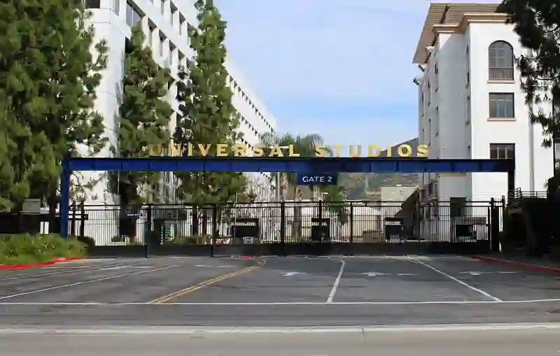
Universal City is a neighborhood in Los Angeles, California, known for its underground metro station on the B Line. The station is situated beneath Lankershim Boulevard, close to the intersection of Campo de Cahuenga and Universal Hollywood Drive. This area is home to notable attractions like Universal Studios Hollywood and the Universal CityWalk entertainment complex. The station itself was established in 2000 and is built around the historic Campo de Cahuenga, which has significance in California's history.
Source: Wikipedia (CC BY-SA 4.0) and Wikidata, rewritten for RoadBreakMap.
EV chargers (101)Public toilets (19)Fuel (13)
Places
Listed with the most recorded facilities first. This is not a rating or a recommendation; always check before you travel.
- Tesla Supercharger
- Open 24 hours
- Fee applies
- Fast EV (50 kW)
- 76
- Carl's Jr.
- Wheelchair access
- Chevron
- Wheelchair access
- In-N-Out Burger
- Opening hours listed
- McDonald's
- Opening hours listed
- 10639 Woodbridge St
- EV up to 3.7 kW
- 10715 Woodbridge St
- EV up to 3.7 kW
- 10921 Whipple St
- EV up to 3.7 kW
- 10922 Landale St
- EV up to 3.7 kW
- 10925 Blix St
- EV up to 3.7 kW
- 10UCP
- EV up to 3 kW
- 10UCP 9128
- EV up to 3.7 kW
- 10UCP BARHAM STAGES 1
- EV up to 3.7 kW
- 10UCP BARHAM STAGES 2
- EV up to 3.7 kW
- 10UCP PRKG LVL 5 - A
- EV up to 3.7 kW
- 10UCP PRKG LVL 5 - B
- EV up to 3.7 kW
- 10UCP PRKG LVL 5 - C
- EV up to 3.7 kW
- 10UCP PRKG LVL 5 - D
- EV up to 3.7 kW
- 10UCP PRKG LVL 5 - G
- EV up to 3.7 kW
- 11022 Camarillo St
- EV up to 3.7 kW
- 11132 Ventura Blvd
- EV up to 3.7 kW
- 11220 Ventura Blvd
- EV up to 3.7 kW
- 11378 W VENTURA BLVD
- EV up to 3.7 kW
- 11647 VENTURA BLVD
- EV up to 3.7 kW
- 3413 CAHUENGA BLVD
- EV up to 3.7 kW
- 3619 Regal Pl
- EV up to 3.7 kW
- 3625 Cahuenga Blvd
- EV up to 3.7 kW
- 3959 Laurel Canyon Blvd
- EV up to 3.7 kW
- 430608 Avalon Studio City
- EV up to 3.7 kW
- 430609 AVA Toluca Hills
- EV up to 3.7 kW
- 4400 Ledge Ave
- EV up to 3.7 kW
- 4407 Laurel Canyon Blvd
- EV up to 3.7 kW
- 4444 Lankershim Blvd
- EV up to 3.7 kW
- 4444 Lankershim Blvd
- EV up to 3.7 kW
- 4648 Lankershim Blvd
- EV up to 3.7 kW
- 6510 Forest Lawn Drive
- EV up to 3.7 kW
- 690 Studio City Lot
- EV up to 3.7 kW
- 76
- AVA Studio City I
- EV up to 3.7 kW
- AVA Studio City II
- EV up to 3.7 kW
- AVA Toluca Hills
- EV up to 3.7 kW
- Abraham At Studio City
- EV up to 3.7 kW
- Arco
- Avalon Studio City
- EV up to 3.7 kW
- CENTURYWESTBMW
- EV up to 3 kW
- HILTON UNIVERSA
- EV up to 3 kW
- LESTANC 1544
- EV up to 3.7 kW
- MPI PHP STAION 2
- EV up to 3.7 kW
- MPI PHP STATION 1
- EV up to 3.7 kW
- Mobil
- Mobil
- Mobil
- Mobil
- STUDIO
- EV up to 3 kW
- STUDIO
- EV up to 3 kW
- STUDIO
- EV up to 3 kW
- STUDIO
- EV up to 3 kW
- STUDIO
- EV up to 3 kW
- STUDIO
- EV up to 3 kW
Showing 60 of 136. See more on the map
Nearby: Hollywood Burbank Koreatown Glendale Los Angeles Van Nuys Inglewood Pasadena Santa Clarita Torrance Downey El Monte
Places, opening hours and charger details come from open data and may be incomplete, out of date or wrong. Never use your phone while driving. Disclaimer & terms