Road stops in Providence, Rhode Island, the United States
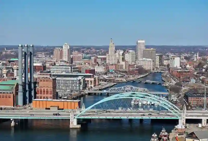
RoadBreakMap lists 1,115 mapped road stops in Providence, Rhode Island, the United States: fuel, EV chargers, rest areas, drive-throughs and public toilets, where the data has them. Data: OpenStreetMap and Open Charge Map.
About Providence
Providence is the capital and largest city of Rhode Island, located in Providence County. Founded in 1636, it developed as a busy port at the mouth of the Providence River and Narragansett Bay. The city has a population of 190,934 and is known for its industrial past, especially in textiles and manufacturing. Today, Providence is home to several hospitals and institutions of higher learning, contributing to its service industries.
Source: Wikipedia (CC BY-SA 4.0) and Wikidata, rewritten for RoadBreakMap.
EV chargers (432)Fuel (302)Drive-throughs (287)Public toilets (79)Diesel (25)Rest areas (15)
Places
Listed with the most recorded facilities first. This is not a rating or a recommendation; always check before you travel.
- ChargePoint
- Open 24 hours
- Fee applies
- ChargePoint
- Open 24 hours
- Free
- EVgo
- Open 24 hours
- Fee applies
- EV up to 40 kW
- Tesla Supercharger
- Open 24 hours
- Free
- Fast EV (150 kW)
- Tesla Supercharger
- Open 24 hours
- Fee applies
- Fast EV (250 kW)
- Tesla Supercharger
- Open 24 hours
- Fee applies
- Fast EV (250 kW)
- Tesla Supercharger
- Open 24 hours
- Fee applies
- Fast EV (250 kW)
- Tesla Supercharger
- Open 24 hours
- Fee applies
- Fast EV (250 kW)
- Tesla Supercharger
- Open 24 hours
- Fee applies
- Fast EV (250 kW)
- Tesla Supercharger
- Open 24 hours
- Fee applies
- Fast EV (50 kW)
- Tesla Supercharger
- Open 24 hours
- Fee applies
- Fast EV (150 kW)
- ChargePoint
- Opening hours listed
- Free
- EV up to 3.7 kW
- Dunkin'
- Opening hours listed
- Wheelchair access
- Dunkin'
- Open 24 hours
- Wheelchair access
- Irving
- Opening hours listed
- Wheelchair access
- Shell
- Open 24 hours
- Speedway
- Open 24 hours
- Tesla Supercharger
- Open 24 hours
- Fee applies
- Fast EV (250 kW)
- EV chargers
- Open 24 hours
- Fee applies
- EV up to 3.7 kW
- Bank of America
- Opening hours listed
- Burger King
- Opening hours listed
- Burger King
- Opening hours listed
- CVS Pharmacy
- Opening hours listed
- Wheelchair access
- CVS Pharmacy
- Open 24 hours
- ChargePoint
- Free
- EV up to 3.7 kW
- ChargePoint
- Free
- EV up to 3.7 kW
- ChargePoint
- Free
- ChargePoint
- Fee applies
- EV up to 3.7 kW
- ChargePoint
- Fee applies
- EV up to 3 kW
- Chase
- Opening hours listed
- Wheelchair access
- Chick-fil-A
- Opening hours listed
- Conoco
- Dunkin'
- Opening hours listed
- Wheelchair access
- Dunkin'
- Opening hours listed
- Dunkin'
- Open 24 hours
- Dunkin'
- Opening hours listed
- Dunkin'
- Open 24 hours
- Dunkin'
- Open 24 hours
- Dunkin'
- Open 24 hours
- Dunkin'
- Open 24 hours
- Dunkin'
- Open 24 hours
- Dunkin'
- Opening hours listed
- Dunkin'
- Opening hours listed
- McDonald's
- Opening hours listed
- McDonald's
- Open 24 hours
- Mercedes-Benz High-Power Charging
- Fee applies
- Mobil
- Open 24 hours
- Mobil
- Mobil
- Rivian Adventure Network
- Fee applies
- Fast EV (200 kW)
- Shell
- Open 24 hours
- Shell
- Open 24 hours
- Shell
- Open 24 hours
- Shell
- Opening hours listed
- Shell
- Shell
- Speedway
- Opening hours listed
- Target Warwick #T1188
- Fee applies
- Fast EV (100 kW)
- EV chargers
- Open 24 hours
- Free
- EV up to 3.7 kW
- EV chargers
- Open 24 hours
- Free
Showing 60 of 1,115. See more on the map
Nearby: Westerly South Boston New Bedford Worcester Boston Ledyard Cambridge Norwich Montville Center New London Waterford Montauk
Places, opening hours and charger details come from open data and may be incomplete, out of date or wrong. Never use your phone while driving. Disclaimer & terms