Road stops in Charlottesville, Virginia, the United States
RoadBreakMap lists 274 mapped road stops in Charlottesville, Virginia, the United States: fuel, EV chargers, rest areas, drive-throughs and public toilets, where the data has them. Data: OpenStreetMap and Open Charge Map.
About Charlottesville
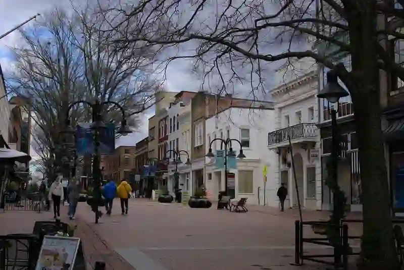
Charlottesville is an independent city in Virginia, serving as the county seat of Albemarle County. It was established in 1762 and has a population of 46,553 as of 2020. The city is known for its historical significance, being home to two U.S. presidents, Thomas Jefferson and James Monroe. The University of Virginia, founded by Jefferson, is located along the city's southwestern border, and Monticello, Jefferson's plantation, is situated just a few miles away. Charlottesville is part of a larger metropolitan area that includes several surrounding counties.
Source: Wikipedia (CC BY-SA 4.0) and Wikidata, rewritten for RoadBreakMap.
Fuel (93)EV chargers (80)Drive-throughs (55)Public toilets (43)Diesel (14)
Places
Listed with the most recorded facilities first. This is not a rating or a recommendation; always check before you travel.
- ChargePoint
- Open 24 hours
- Fee applies
- Fast EV (62.5 kW)
- Tesla Supercharger
- Open 24 hours
- Fee applies
- Fast EV (150 kW)
- Tesla Supercharger
- Open 24 hours
- Fee applies
- Fast EV (250 kW)
- Tesla Supercharger
- Open 24 hours
- Fee applies
- Tesla Supercharger
- Open 24 hours
- Fee applies
- Fast EV (250 kW)
- Crossroad Corner Store
- Open 24 hours
- Sheetz
- Open 24 hours
- Wheelchair access
- Sheetz
- Open 24 hours
- Wheelchair access
- Shell
- Open 24 hours
- 7-Eleven
- Open 24 hours
- BP
- Opening hours listed
- Bojangles'
- Opening hours listed
- Caul's Grocery CITGO
- Opening hours listed
- Electrify America
- Fee applies
- Fast EV (350 kW)
- Exxon
- Open 24 hours
- Exxon
- Open 24 hours
- Greenlots
- Open 24 hours
- EV up to 3.7 kW
- Sheetz
- Open 24 hours
- Sheetz
- Open 24 hours
- Shell
- Open 24 hours
- Signet Systems
- Open 24 hours
- EV charging
- Arby's
- Opening hours listed
- Arby's
- Arby's
- Opening hours listed
- Atlantic Union Bank
- Opening hours listed
- BP
- Wheelchair access
- BP
- BP
- BP
- Bank of America
- Opening hours listed
- Burger King
- Opening hours listed
- Burger King
- Opening hours listed
- Burger King
- Opening hours listed
- Burger King
- Opening hours listed
- ChargePoint
- EV up to 3.7 kW
- Charlottesville Safety Rest Area West
- Chase
- Opening hours listed
- Chick-fil-A
- Opening hours listed
- Chick-fil-A
- Opening hours listed
- Chick-fil-A
- Opening hours listed
- Costco Gasoline
- Dunkin'
- Opening hours listed
- Dunkin'
- Opening hours listed
- Dunkin'
- Opening hours listed
- Dunkin'
- Opening hours listed
- Dunkin'
- Opening hours listed
- Exxon
- Opening hours listed
- Exxon
- Opening hours listed
- Exxon
- Opening hours listed
- Exxon
- First Citizens Bank
- Opening hours listed
- Ford Blue Oval
- Fee applies
- McDonald's
- Opening hours listed
- McDonald's
- Opening hours listed
- McDonald's
- Opening hours listed
- McDonald's
- Opening hours listed
- McDonald's
- Opening hours listed
- Mobil
- Popeyes
- Opening hours listed
- Quarles
Showing 60 of 274. See more on the map
Nearby: Woodberry Forest Louisa Waynesboro Harrisonburg Cumberland Luray Staunton Culpeper Mount Jackson Farmville Woodstock Front Royal
Places, opening hours and charger details come from open data and may be incomplete, out of date or wrong. Never use your phone while driving. Disclaimer & terms