Road stops in Khust, Zakarpattia, Ukraine
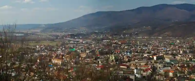
RoadBreakMap lists 51 mapped road stops in Khust, Zakarpattia, Ukraine: fuel, EV chargers, rest areas, drive-throughs and public toilets, where the data has them. Data: OpenStreetMap and Open Charge Map.
About Khust
Khust is a territorial hromada located in the Zakarpattia region of Ukraine. It serves as the administrative center of Khust Raion and covers an area of 402.3 square kilometers. The population is approximately 81,136 as of 2020, making it a significant urban area in the region.
Source: Wikipedia (CC BY-SA 4.0) and Wikidata, rewritten for RoadBreakMap.
Fuel (31)Diesel (19)Public toilets (13)
Places
Listed with the most recorded facilities first. This is not a rating or a recommendation; always check before you travel.
- Укрнафта
- Open 24 hours
- Chipo
- Open 24 hours
- UPG
- Open 24 hours
- WOG
- Open 24 hours
- WOG
- Open 24 hours
- ОККО
- Open 24 hours
- Chipo
- Open 24 hours
- Chipo
- Open 24 hours
- ОККО
- Open 24 hours
- Toka
- Open 24 hours
- UPG
- Open 24 hours
- UPG
- Open 24 hours
- UPG
- Open 24 hours
- Тока
- Open 24 hours
- БРСМ-Нафта
- БРСМ-Нафта
- Маркет
- Public toilets
- Fee applies
- TOKA #733 BRSM Fast Charger
- Fast EV (120 kW)
- silverland
- Fast EV (50 kW)
- ДГАС
- Маркет
- Маркет
- Fuel
- Fuel
- Public toilets
- Fee applies
- A1 charger
- Eleron
- Sun Oil
- АЗС «Робітник»
- Готельно-ресторанний комплекс PRINCE
- EV up to 22 kW
- Fuel
- Fuel
- Fuel
- Fuel
- Fuel
- Fuel
- Fuel
- Fuel
- Rest areas
- Public toilets
- Public toilets
- Public toilets
- Public toilets
- Public toilets
- Public toilets
- Public toilets
- Public toilets
- Public toilets
- Public toilets
- Public toilets
Nearby: Mizhhirya Vynohradiv Svalyava Berehove Rakhiv Dolyna Uzhhorod Truskavets Boryslav Stebnyk Stryi Drohobych
Places, opening hours and charger details come from open data and may be incomplete, out of date or wrong. Never use your phone while driving. Disclaimer & terms