Road stops in Keelung, Taiwan, Taiwan
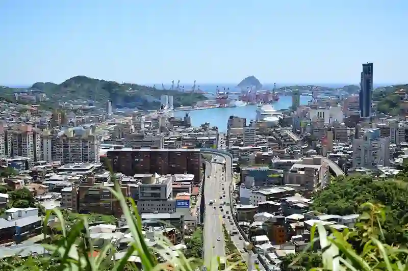
RoadBreakMap lists 338 mapped road stops in Keelung, Taiwan, Taiwan: fuel, EV chargers, rest areas, drive-throughs and public toilets, where the data has them. Data: OpenStreetMap and Open Charge Map.
About Keelung
Keelung is a provincial-level city located in Taiwan and is the northernmost city in the country. It is known as a major port city and is part of the Taipei–Keelung metropolitan area. The city has a population of 359,102 and sits at an elevation of 10 meters. Founded in 1945, Keelung is next to the Keelung River and is Taiwan's second largest seaport.
Source: Wikipedia (CC BY-SA 4.0) and Wikidata, rewritten for RoadBreakMap.
Public toilets (279)Fuel (42)EV chargers (14)
Places
Listed with the most recorded facilities first. This is not a rating or a recommendation; always check before you travel.
- 台灣中油
- Open 24 hours
- 台灣中油
- Open 24 hours
- 麥當勞
- Opening hours listed
- Wheelchair access
- 北基加油站基金站
- Open 24 hours
- 台灣中油
- Opening hours listed
- 台灣中油八德路加油站 直營
- 跳石海濱公園公廁
- Wheelchair access
- Free
- Public toilets
- Wheelchair access
- Free
- Public toilets
- Wheelchair access
- Free
- Public toilets
- Opening hours listed
- Wheelchair access
- Free
- Public toilets
- Wheelchair access
- Baby change
- Free
- Public toilets
- Wheelchair access
- Free
- 1樓男、女、輪椅族三種
- Wheelchair access
- Free
- GOGORO 電池交換站
- GOGORO 電池交換站 中油成功一路站
- Gogoro 電池交換站
- Gogoro 電池交換站
- Gogoro 電池交換站
- Gogoro 電池交換站 - 全家平溪十分店站
- Gogoro 電池交換站 - 新北市貢寮市民活動中心站
- Gogoro 電池交換站 WorldGym 信義店 Sport站
- Gogoro 電池交換站 中油安樂站
- Gogoro 電池交換站 南山社區站
- 台灣中油
- 廁所
- Wheelchair access
- Free
- 西定路加油站
- Opening hours listed
- 麥當勞
- Opening hours listed
- Public toilets
- Wheelchair access
- Free
- Public toilets
- Wheelchair access
- Free
- Public toilets
- Wheelchair access
- Free
- Public toilets
- Wheelchair access
- Free
- Public toilets
- Free
- Public toilets
- Free
- Public toilets
- Wheelchair access
- Free
- Public toilets
- Free
- Public toilets
- Open 24 hours
- Public toilets
- Wheelchair access
- Free
- Public toilets
- Wheelchair access
- Free
- Public toilets
- Wheelchair access
- Free
- Public toilets
- Wheelchair access
- Free
- Public toilets
- Wheelchair access
- Free
- Public toilets
- Wheelchair access
- Free
- Public toilets
- Wheelchair access
- Free
- Public toilets
- Wheelchair access
- Free
- Public toilets
- Wheelchair access
- Baby change
- Public toilets
- Wheelchair access
- Free
- Go Station 換電站 - 中油北基基金站
- Gogoro
- Tesla Supercharger Keelung - Xiaodong Road
- Fast EV (250 kW)
- 全國加油站
- 北基加油站
- 台塑石油
- 台塑石油
- 台塑石油
- 台塑石油
- 台塑石油
- 台塑石油
- 台灣中油
- 台灣中油
- 台灣中油
Showing 60 of 338. See more on the map
Nearby: Neihu Xizhi Taipei Banqiao Danshui New Taipei City Shulin Sanxia Yilan Taoyuan Bade Neili
Places, opening hours and charger details come from open data and may be incomplete, out of date or wrong. Never use your phone while driving. Disclaimer & terms