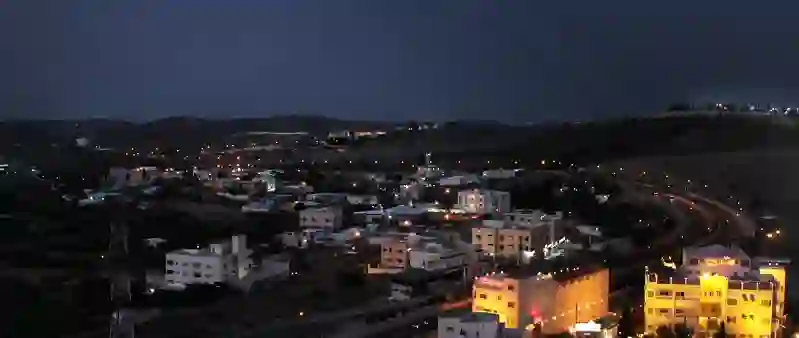
Road stops in Ta’if, Mecca Region, Saudi Arabia
RoadBreakMap lists 140 mapped road stops in Ta’if, Mecca Region, Saudi Arabia: fuel, EV chargers, rest areas, drive-throughs and public toilets, where the data has them. Data: OpenStreetMap and Open Charge Map.
About Ta’if
Ta’if is a city in Saudi Arabia located in the Mecca Region. It is situated at an elevation of 1,879 meters in the Hijaz Mountains. The city is known for its agricultural output and is the center of an area that cultivates grapes, pomegranates, figs, roses, and honey. Ta’if has a population of 563,282 people as of 2022 and is the capital of the Ta'if governorate, which includes 15 municipalities. The city is also connected to the resort town of Al-Hada via Highway 15 and is served by Taif International Airport.
Source: Wikipedia (CC BY-SA 4.0) and Wikidata, rewritten for RoadBreakMap.
Fuel (97)Diesel (39)Public toilets (26)
Places
Listed with the most recorded facilities first. This is not a rating or a recommendation; always check before you travel.
- Jouri Mall Supercharger
- Open 24 hours
- Fee applies
- ساسكو
- Open 24 hours
- Public toilets
- Wheelchair access
- Free
- Public toilets
- Wheelchair access
- Free
- Public toilets
- Wheelchair access
- Free
- Public toilets
- Wheelchair access
- Free
- Public toilets
- Wheelchair access
- Free
- Electromin
- Opening hours listed
- Electromin
- Opening hours listed
- Electromin
- Opening hours listed
- البنك الأهلي السعودي
- البنك الأهلي السعودي
- الدريس
- الدريس
- الدريس
- الدريس
- الدريس
- الدريس
- بنزول
- جي أويل
- ساسكو
- ساسكو
- لتر
- محطة الخالدية
- Open 24 hours
- مصرف الراجحي
- Public toilets
- Wheelchair access
- Free
- Public toilets
- Wheelchair access
- Free
- Public toilets
- Wheelchair access
- Free
- Public toilets
- Wheelchair access
- Free
- Well
- الأمانة
- البهجة
- الخليج
- الخماش
- الدريس
- الدريس
- الدريس
- الدريس
- الدريس
- الدريس
- الدريس
- الدريس
- الشريف
- الشهيب
- الشيباني
- العيدروس
- الفيصل
- المجد
- المعمورة
- الوادي1
- الوسام
- الوفاء
- بامب
- بترومين
- بترومين
- جبرا
- دانكن دونتس
- درب
- درب
- رماح
Showing 60 of 140. See more on the map
Nearby: Makkah Al Līth Jeddah Khulayş Thuwal Al Bahah Rābigh Sabt Alalayah Ranyah Bīshah Badr Ḩunayn Madinah
Places, opening hours and charger details come from open data and may be incomplete, out of date or wrong. Never use your phone while driving. Disclaimer & terms