Road stops in Murmansk, Murmansk, Russia
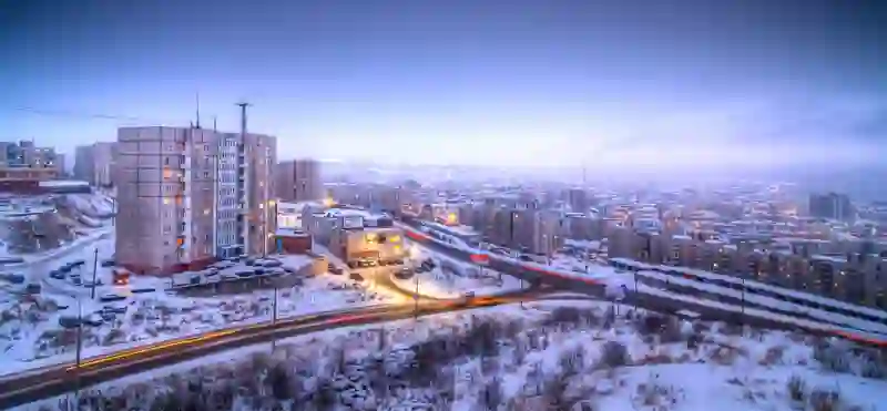
RoadBreakMap lists 97 mapped road stops in Murmansk, Russia: fuel, EV chargers, rest areas, drive-throughs and public toilets, where the data has them. Data: OpenStreetMap and Open Charge Map.
About Murmansk
Murmansk is a significant city located in the northwest of Russia, serving as the administrative center of Murmansk Oblast. It is positioned on the banks of Kola Bay and is known for being the most populous city north of the Arctic Circle. Founded in 1916, Murmansk has developed into a major port city with year-round access to the Arctic Ocean, thanks to its non-freezing port. The city features both highway and railway connections to Europe, making it an important hub in the region. Despite experiencing a population decline since the end of the Cold War, Murmansk remains a key location in the Arctic, with a climate influenced by the warm North Atlantic Current.
Source: Wikipedia (CC BY-SA 4.0) and Wikidata, rewritten for RoadBreakMap.
Fuel (50)Diesel (29)Public toilets (28)Rest areas (17)
Places
Listed with the most recorded facilities first. This is not a rating or a recommendation; always check before you travel.
- Лукойл
- Open 24 hours
- Лукойл
- Open 24 hours
- Лукойл
- Open 24 hours
- Лукойл
- Open 24 hours
- Лукойл
- Open 24 hours
- Лукойл
- Open 24 hours
- Circle K
- Open 24 hours
- Лукойл
- Open 24 hours
- Роснефть
- Open 24 hours
- Роснефть
- Open 24 hours
- Роснефть
- Open 24 hours
- Роснефть
- Open 24 hours
- Роснефть
- Open 24 hours
- Роснефть
- Open 24 hours
- Роснефть
- Open 24 hours
- Роснефть
- Open 24 hours
- Роснефть
- Open 24 hours
- Витэк
- Open 24 hours
- Газпромнефть
- Open 24 hours
- Газпромнефть
- Open 24 hours
- Северное
- Open 24 hours
- Public toilets
- Opening hours listed
- Wheelchair access
- Free
- Circle K
- Open 24 hours
- Варламово
- Open 24 hours
- Газпромнефть
- Open 24 hours
- Газпромнефть
- Open 24 hours
- Вкусно - и точка
- Opening hours listed
- Газпромнефть
- Open 24 hours
- Нижняя заправка
- Open 24 hours
- Скарус
- ЮНИС-С
- Public toilets
- Fee applies
- Public toilets
- Opening hours listed
- Public toilets
- Fee applies
- Public toilets
- Opening hours listed
- Public toilets
- Opening hours listed
- Fee applies
- Public toilets
- Free
- Panex газ
- ВиТЭК
- Витэк
- Витэк
- Газпромнефть
- Росгаз
- Росгаз
- Росгаз
- Скарус
- Public toilets
- Free
- Public toilets
- Public toilets
- Public toilets
- Public toilets
- Public toilets
- Public toilets
- Public toilets
- Free
- Public toilets
- Opening hours listed
- Public toilets
- Opening hours listed
- Park Inn by Raddison Poliarnie Zori, Murmansk
- EV up to 11 kW
- Альянсойл
- ВиТЭК
- ВиТЭК №1
Showing 60 of 97. See more on the map
Nearby: Olenegorsk Monchegorsk Apatity Kirovsk Polyarnyye Zori Kandalaksha Nikel Kostomuksha Segezha Onega Petrozavodsk Sortavala
Places, opening hours and charger details come from open data and may be incomplete, out of date or wrong. Never use your phone while driving. Disclaimer & terms