Road stops in Battambang, Battambang, Cambodia
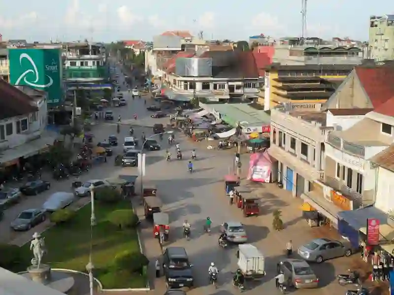
RoadBreakMap lists 97 mapped road stops in Battambang, Cambodia: fuel, EV chargers, rest areas, drive-throughs and public toilets, where the data has them. Data: OpenStreetMap and Open Charge Map.
About Battambang
Battambang is a city located in northwestern Cambodia and serves as the capital of Battambang province. The city features a railway station established in 1933, which is an important part of its transportation network. The downtown area includes National Highway 5, intersecting with Streets 207 and 212, near the central market, making it a key location for both locals and visitors.
Source: Wikipedia (CC BY-SA 4.0) and Wikidata, rewritten for RoadBreakMap.
Places
Listed with the most recorded facilities first. This is not a rating or a recommendation; always check before you travel.
- CG EV
- Open 24 hours
- Caltex
- Wheelchair access
- Caltex
- Fuel
- Open 24 hours
- Public toilets
- Wheelchair access
- Free
- Public toilets
- Wheelchair access
- Free
- Public toilets
- Baby change
- Free
- Public toilets
- Wheelchair access
- Free
- Public toilets
- Wheelchair access
- Free
- PTT Station
- Wheelchair access
- Sokimex
- Wheelchair access
- Tela
- Opening hours listed
- Total
- EV chargers
- Public toilets
- Free
- Public toilets
- Free
- Public toilets
- Fee applies
- Caltex
- Depottela
- LHR
- LHR
- LHR
- LHR
- LHR
- MPL
- MPL
- PTT
- SK Gas
- SVM
- Sokimex
- Sokimex
- Sokimex
- Sokimex
- Sokimex
- TR Petrolium
- TR Petrolium
- Tela
- Tela
- Tela
- Tela
- Tela
- Tela
- Tela
- Tela
- Tela
- Tela
- Tela
- Total
- Total
- Zara Coffee Battambang
- Fast EV (60 kW)
- pttstation
- tela
- បមបេញ
- Fuel
- Fuel
- Fuel
- Fuel
- Fuel
- Fuel
- Fuel
Showing 60 of 97. See more on the map
Nearby: Sisophon Yeang Pailin Paoy Paet Siem Reap Pursat Samraong Phumĭ Tnaôt Anlong Veaeng Koh Kong Kampong Chhnang Kampong Thom
Places, opening hours and charger details come from open data and may be incomplete, out of date or wrong. Never use your phone while driving. Disclaimer & terms