Road stops in Lamía, Central Greece, Greece
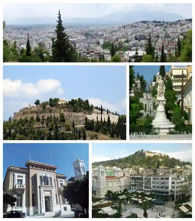
RoadBreakMap lists 184 mapped road stops in Lamía, Central Greece, Greece: fuel, EV chargers, rest areas, drive-throughs and public toilets, where the data has them. Data: OpenStreetMap and Open Charge Map.
About Lamía
Lamía is a city located in central Greece, serving as the capital of the regional unit of Phthiotis. The city has a population of around 47,529 and is positioned on the slopes of Mount Othrys, close to the river Spercheios. Lamía is known for its agricultural significance, being the center of a fertile area for farming and livestock.
Source: Wikipedia (CC BY-SA 4.0) and Wikidata, rewritten for RoadBreakMap.
Fuel (102)EV chargers (54)Rest areas (25)
Places
Listed with the most recorded facilities first. This is not a rating or a recommendation; always check before you travel.
- CEV - Hub Lamia
- Open 24 hours
- Fee applies
- EV charging
- ChargePlus - My Market Λαμία
- Open 24 hours
- Fee applies
- EV charging
- Chargespot - Istikbal
- Open 24 hours
- Fee applies
- EV charging
- Chargespot - Renault Auto Club
- Open 24 hours
- Fee applies
- EV charging
- Chargespot - Samaras Hotel
- Open 24 hours
- Fee applies
- EV charging
- Chargespot - Γαλαξίας Άμπλιανη
- Open 24 hours
- Fee applies
- EV charging
- Chargespot - Γαλαξίας Γαλανέϊκα
- Open 24 hours
- Fee applies
- EV charging
- Chargespot - Γαλαξίας Μακρακώμη
- Open 24 hours
- Fee applies
- EV charging
- Chargespot - Γαλαξίας Ρεβένια
- Open 24 hours
- Fee applies
- EV charging
- Chargespot - Γαλαξίας Στυλίδα
- Open 24 hours
- Fee applies
- EV charging
- Chargespot - ΚΑΛΑΜΑΤΑΣ
- Open 24 hours
- Fee applies
- EV charging
- Chargespot - Παναγροτική
- Open 24 hours
- Fee applies
- EV charging
- DEI blue - Σκλαβενίτης
- Open 24 hours
- Fee applies
- EV charging
- DΕΙ blue - Pavliani Houses - Kallis Prison
- Open 24 hours
- Fee applies
- EV charging
- DΕΙ blue - Αμβρόσιος
- Open 24 hours
- Fee applies
- EV charging
- DΕΙ blue - ΔΕΗ Λαμίας
- Open 24 hours
- Fee applies
- EV charging
- DΕΙ blue - Σκλαβενίτης
- Open 24 hours
- Fee applies
- Fast EV (150 kW)
- EKO Charge&Go - EKO Μπλάνης
- Open 24 hours
- Fee applies
- EV charging
- EVziiin - Αγροδομή Λαμίας
- Open 24 hours
- Fee applies
- EV charging
- Electrip - Hotel Athina
- Open 24 hours
- Fee applies
- EV charging
- Joltie - 222 Igloo
- Open 24 hours
- Fee applies
- EV charging
- Joltie - Karellis Group
- Open 24 hours
- Fee applies
- EV charging
- Joltie - Market In
- Open 24 hours
- Fee applies
- Joltie - Parking Μπρέκης
- Open 24 hours
- Fee applies
- EV charging
- Joltie - STAR Κεντρικής Ελλάδας
- Open 24 hours
- Fee applies
- EV charging
- Joltie - Super Market Koularmani
- Open 24 hours
- Fee applies
- EV charging
- Joltie - Έπιπλο Καρκάνης
- Open 24 hours
- Fee applies
- EV charging
- Joltie - Ερευνητικό Ιατρική AE
- Open 24 hours
- Fee applies
- EV charging
- nrg - AVIN 4179
- Open 24 hours
- Fee applies
- EV charging
- nrg - AVIN 4196
- Open 24 hours
- Fee applies
- EV charging
- nrg - AVIN Λαμία
- Open 24 hours
- Fee applies
- EV charging
- nrg - My market Δομοκός
- Open 24 hours
- Fee applies
- EV charging
- nrg - My market Λαμία Παγκράτι
- Open 24 hours
- Fee applies
- EV charging
- nrg - Shell 146
- Open 24 hours
- Fee applies
- EV charging
- nrg - Shell 486
- Open 24 hours
- Fee applies
- EV charging
- nrg - Travel Stop Λαμίας
- Open 24 hours
- Fee applies
- EV charging
- nrg - ΣΕΑ Λιανοκλαδίου AVIN 4208
- Open 24 hours
- Fee applies
- EV charging
- nrg - ΣΕΑ Λιανοκλαδίου AVIN 4209
- Open 24 hours
- Fee applies
- EV charging
- DEI blue - ΑΒ Βασιλόπουλος
- Opening hours listed
- Fee applies
- EV charging
- DEI blue - ΑΒ Βασιλόπουλος
- Opening hours listed
- Fee applies
- EV charging
- DΕΙ blue - ελίν Στέφος
- Opening hours listed
- Fee applies
- EV charging
- EKO Charge&Go - BP Κρέτσης
- Opening hours listed
- Fee applies
- EV charging
- Lidl Λαμία
- Opening hours listed
- Free
- EV charging
- Lidl Στυλίδα
- Opening hours listed
- Free
- EV charging
- nrg - METRO Cash & Carry
- Opening hours listed
- Fee applies
- EV charging
- nrg - Μασούτης Λαμία
- Opening hours listed
- Fee applies
- EV charging
- nrg - Πασιονίκος Στάθμευση
- Opening hours listed
- Fee applies
- EV charging
- BP
- Opening hours listed
- BP
- Opening hours listed
- BP
- Chargespot - Gklantzounis Motors
- Fee applies
- EV charging
- Chargespot - HOME Gym
- Fee applies
- EV charging
- nrg - Όλυμπος Γάλακτος
- Fee applies
- EV charging
- ΕΛΙΝΟΙΛ
- Opening hours listed
- AEGEAN
- AVIN
- AVIN
- AVIN
- AVIN
- AVIN
Showing 60 of 184. See more on the map
Nearby: Ámfissa Itéa Livadeiá Néa Ionía Karpenísi Kardítsa Lárisa Volos Aígio Xylókastro Thívai Pátra
Places, opening hours and charger details come from open data and may be incomplete, out of date or wrong. Never use your phone while driving. Disclaimer & terms