Road stops in Lourdes, Occitanie, France
RoadBreakMap lists 185 mapped road stops in Lourdes, Occitanie, France: fuel, EV chargers, rest areas, drive-throughs and public toilets, where the data has them. Data: OpenStreetMap and Open Charge Map.
About Lourdes
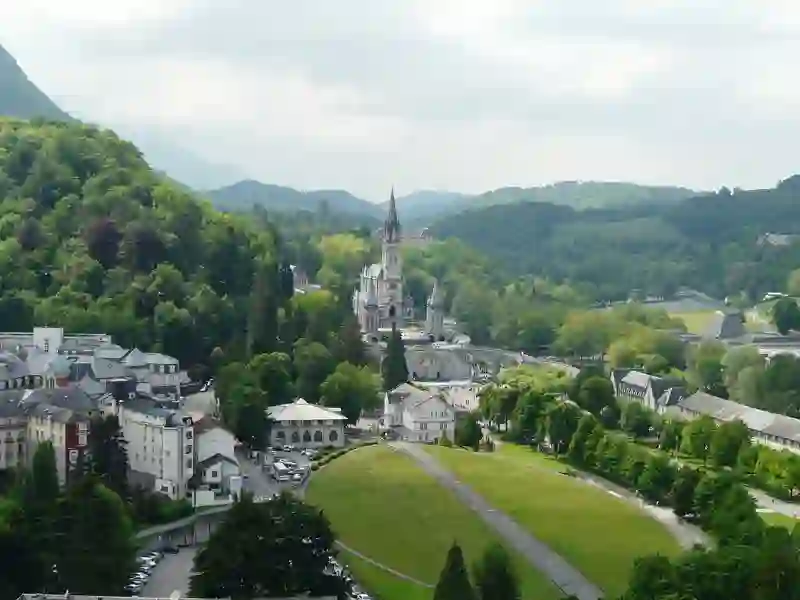
Lourdes is a commune located in the Hautes-Pyrénées department of the Occitanie region in France. This market town is situated near the Gave de Pau River and has an elevation of 420 meters. With a population of over 13,000, Lourdes is known for its historical significance, particularly due to the Marian apparitions experienced by Bernadette Soubirous in the mid-19th century. The town features a prominent fortified castle at its center and has become a major site for pilgrimage and religious tourism.
Source: Wikipedia (CC BY-SA 4.0) and Wikidata, rewritten for RoadBreakMap.
Public toilets (113)EV chargers (42)Fuel (24)Diesel (23)
Places
Listed with the most recorded facilities first. This is not a rating or a recommendation; always check before you travel.
- Relais Total du Jer
- Open 24 hours
- Carrefour
- Open 24 hours
- Intermarché
- Open 24 hours
- Wheelchair access
- Total
- Open 24 hours
- Carrefour
- Open 24 hours
- Carrefour
- Open 24 hours
- Wheelchair access
- Carrefour Market
- Open 24 hours
- Elan
- Open 24 hours
- Elan
- Open 24 hours
- Garage de la Plaine
- Open 24 hours
- Intermarché
- Open 24 hours
- Intermarché
- Open 24 hours
- Station service Yves Crepel
- Open 24 hours
- Argelès-Gazost - Roquette Buisson
- Open 24 hours
- Fee applies
- EV up to 18 kW
- Carrefour Market
- Opening hours listed
- Wheelchair access
- E. Leclerc
- Open 24 hours
- Esso Express
- Open 24 hours
- Netto
- Open 24 hours
- Place de Vieuzac
- Open 24 hours
- Fee applies
- EV up to 18 kW
- Proxi
- Open 24 hours
- Total
- Open 24 hours
- EV chargers
- Open 24 hours
- Fee applies
- EV up to 18 kW
- EV chargers
- Open 24 hours
- Fee applies
- EV up to 18 kW
- EV chargers
- Open 24 hours
- Fee applies
- EV up to 18 kW
- EV chargers
- Open 24 hours
- Fee applies
- EV up to 18 kW
- Public toilets
- Open 24 hours
- Wheelchair access
- Free
- Public toilets
- Open 24 hours
- Wheelchair access
- Free
- Public toilets
- Open 24 hours
- Wheelchair access
- Free
- E. Leclerc
- Opening hours listed
- Garage Secula
- Reveo
- Opening hours listed
- Wheelchair access
- EV charging
- EV chargers
- Opening hours listed
- Wheelchair access
- EV up to 18 kW
- EV chargers
- Opening hours listed
- Wheelchair access
- EV up to 18 kW
- Public toilets
- Opening hours listed
- Wheelchair access
- Free
- Public toilets
- Wheelchair access
- Free
- Public toilets
- Wheelchair access
- Free
- Public toilets
- Wheelchair access
- Free
- Public toilets
- Free
- Burger King
- Opening hours listed
- Elan
- McDonald's
- Opening hours listed
- Relais d'Azun Total
- Reveo
- Fee applies
- EV up to 18 kW
- Reveo
- Fee applies
- Public toilets
- Wheelchair access
- Free
- Public toilets
- Wheelchair access
- Free
- Public toilets
- Wheelchair access
- Free
- Public toilets
- Wheelchair access
- Free
- Public toilets
- Wheelchair access
- Free
- Public toilets
- Wheelchair access
- Fee applies
- Public toilets
- Free
- Public toilets
- Free
- Public toilets
- Wheelchair access
- Free
- Public toilets
- Wheelchair access
- Public toilets
- Free
- Public toilets
- Wheelchair access
- Free
- Public toilets
- Free
- Public toilets
- Wheelchair access
- Free
- Public toilets
- Wheelchair access
- Free
- Public toilets
- Wheelchair access
- Free
Showing 60 of 185. See more on the map
Nearby: Tarbes Aragnouet Laruns Pau Loudenvielle Orthez Eauze Auch Mont-de-Marsan Condom Saint-Jean-Pied-de-Port Dax
Places, opening hours and charger details come from open data and may be incomplete, out of date or wrong. Never use your phone while driving. Disclaimer & terms