Road stops in Chaumont, Grand Est, France
RoadBreakMap lists 93 mapped road stops in Chaumont, Grand Est, France: fuel, EV chargers, rest areas, drive-throughs and public toilets, where the data has them. Data: OpenStreetMap and Open Charge Map.
About Chaumont
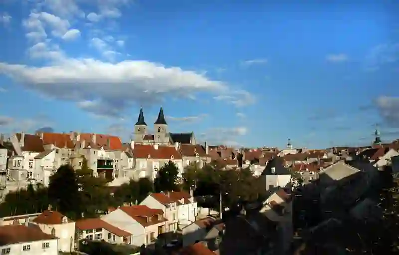
Chaumont is a commune located in Haute-Marne, France, and serves as the prefecture of the Haute-Marne department. With a population of around 20,827, it is situated along the Marne River. The town is known for its railway station, which connects to several major cities, including Paris and Dijon. Chaumont features notable structures such as the Basilique Saint Jean-Baptiste and the Tour d'Arse, adding to its local character.
Source: Wikipedia (CC BY-SA 4.0) and Wikidata, rewritten for RoadBreakMap.
EV chargers (35)Public toilets (27)Fuel (19)Diesel (16)Rest areas (12)
Places
Listed with the most recorded facilities first. This is not a rating or a recommendation; always check before you travel.
- Intermarché
- Open 24 hours
- E. Leclerc
- Open 24 hours
- Wheelchair access
- Esso
- Open 24 hours
- Relais Elf de Buxereuilles
- Open 24 hours
- Total
- Open 24 hours
- Total
- Open 24 hours
- Aire de Châteauvillain - Orges Supercharger
- Open 24 hours
- Fee applies
- Fast EV (300 kW)
- Aire de Châteauvillain - Val Marnay Supercharger
- Open 24 hours
- Fee applies
- EV charging
- Avia
- Open 24 hours
- Esso Express
- Open 24 hours
- Wheelchair access
- Intermarché
- Open 24 hours
- Intermarché
- Open 24 hours
- Intermarché Super
- Open 24 hours
- Aire de Châteauvillain-Est
- Open 24 hours
- Fee applies
- EV charging
- ENGIE Châteauvillain Orges
- Open 24 hours
- Fee applies
- EV charging
- ENGIE Châteauvillain Valmarnay
- Open 24 hours
- Fee applies
- Fast EV (300 kW)
- Intermarché
- Open 24 hours
- Station U
- Open 24 hours
- Station de Recharge - Route de Chatillon
- Open 24 hours
- Fee applies
- EV charging
- Station de Recharge - Rue du Parc
- Open 24 hours
- Fee applies
- EV charging
- EV chargers
- Open 24 hours
- Fee applies
- EV charging
- Public toilets
- Open 24 hours
- Wheelchair access
- Free
- Public toilets
- Open 24 hours
- Wheelchair access
- Free
- Avia
- Public toilets
- Free
- Avia
- Elan
- Powerdot
- Fast EV (200 kW)
- Total
- Public toilets
- Opening hours listed
- Free
- Public toilets
- Wheelchair access
- Free
- Public toilets
- Wheelchair access
- Free
- Public toilets
- Wheelchair access
- Free
- Public toilets
- Wheelchair access
- Free
- Public toilets
- Wheelchair access
- Free
- Aire de Val de Gris
- Aire du Bois-Moyen
- Aire du Champ à la Croix
- Aire du Champ à la Croix
- MR BRICOLAGE - FAUBOURG DU MOULIN NEUF 52006
- EV up to 22 kW
- PowerDot - Super U - Nogent
- Fast EV (200 kW)
- Q8 Langre
- STATION AVIA - NOGENT
- EV up to 22 kW
- EV chargers
- EV chargers
- Fee applies
- EV charging
- EV chargers
- Fee applies
- EV charging
- EV chargers
- Fee applies
- EV charging
- EV chargers
- Fee applies
- EV charging
- EV chargers
- Fee applies
- EV charging
- EV chargers
- Fee applies
- EV charging
- EV chargers
- Fee applies
- EV charging
- EV chargers
- Fee applies
- EV charging
- EV chargers
- Fee applies
- Rest areas
- Rest areas
- Public toilets
- Fee applies
- Public toilets
- Public toilets
- Wheelchair access
- Public toilets
- Public toilets
Showing 60 of 93. See more on the map
Nearby: Perrogney-les-Fontaines Val-de-Meuse Saint-Dizier Châtillon-sur-Seine Neufchâteau Bar-le-Duc Brienne-le-Château Contrexéville Dijon Vitry-le-François Troyes Verdun
Places, opening hours and charger details come from open data and may be incomplete, out of date or wrong. Never use your phone while driving. Disclaimer & terms