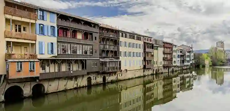
Road stops in Castres, Occitanie, France
RoadBreakMap lists 181 mapped road stops in Castres, Occitanie, France: fuel, EV chargers, rest areas, drive-throughs and public toilets, where the data has them. Data: OpenStreetMap and Open Charge Map.
About Castres
Castres is a commune located in the Tarn department of France, within the Occitanie region. It serves as the sole subprefecture of Tarn and is positioned in the cantons of Castres-Est and Castres-Nord. With a population of 42,505, it stands as the fourth-largest industrial center in the former Midi-Pyrénées region, following Toulouse, Tarbes, and Albi. The town is recognized for its historical significance and is home to the Goya Museum, which showcases Spanish painting.
Source: Wikipedia (CC BY-SA 4.0) and Wikidata, rewritten for RoadBreakMap.
Public toilets (88)EV chargers (55)Fuel (28)Diesel (20)
Places
Listed with the most recorded facilities first. This is not a rating or a recommendation; always check before you travel.
- Auchan
- Open 24 hours
- E. Leclerc
- Open 24 hours
- Wheelchair access
- Auchan
- Open 24 hours
- TotalEnergies
- Open 24 hours
- Wheelchair access
- Dyneff
- Open 24 hours
- Wheelchair access
- Esso Express Miredames
- Open 24 hours
- Netto
- Open 24 hours
- Station Service E. Leclerc - Castres
- Open 24 hours
- Station Service U
- Open 24 hours
- Station U
- Open 24 hours
- Station U
- Open 24 hours
- Station service Intermarché
- Open 24 hours
- Castres - Mélou - Route de Toulouse
- Open 24 hours
- Fee applies
- EV charging
- Castres - Place Soult - Parking Extérieur
- Open 24 hours
- Fee applies
- EV up to 22 kW
- Dyneff
- Open 24 hours
- Intermarché
- Open 24 hours
- Station Service
- Open 24 hours
- Total Access
- Open 24 hours
- Viviers-lès-Montagnes - Place du 8 Mai 1945
- Open 24 hours
- Fee applies
- EV up to 22 kW
- EV chargers
- Open 24 hours
- Fee applies
- EV up to 18 kW
- EV chargers
- Open 24 hours
- Fee applies
- EV up to 18 kW
- EV chargers
- Open 24 hours
- Fee applies
- EV up to 18 kW
- EV chargers
- Open 24 hours
- Fee applies
- EV charging
- EV chargers
- Open 24 hours
- Fee applies
- EV up to 18 kW
- EV chargers
- Open 24 hours
- Fee applies
- EV charging
- EV chargers
- Open 24 hours
- Fee applies
- EV up to 22 kW
- Public toilets
- Open 24 hours
- Wheelchair access
- Free
- Public toilets
- Open 24 hours
- Wheelchair access
- Free
- Public toilets
- Open 24 hours
- Free
- Public toilets
- Wheelchair access
- Free
- Borne de recharge des Cammazes
- Free
- EV charging
- E. Leclerc
- Intermarché
- Opening hours listed
- TotalEnergies
- Public toilets
- Open 24 hours
- Free
- Public toilets
- Wheelchair access
- Free
- Burger King
- Opening hours listed
- Burger King
- Opening hours listed
- Esso
- McDonald's
- Opening hours listed
- McDonald's
- Opening hours listed
- OMI
- Révéo
- EV up to 18 kW
- SP 98, SP 95-E10, gasoil, station de gonflage.
- Open 24 hours
- Station Service Municipale
- Open 24 hours
- Public toilets
- Wheelchair access
- Free
- Public toilets
- Free
- Public toilets
- Wheelchair access
- Free
- Public toilets
- Wheelchair access
- Free
- Public toilets
- Wheelchair access
- Free
- Public toilets
- Free
- Public toilets
- Wheelchair access
- Free
- Public toilets
- Fee applies
- Public toilets
- Free
- Public toilets
- Wheelchair access
- Free
- Public toilets
- Wheelchair access
- Public toilets
- Open 24 hours
- Public toilets
- Wheelchair access
- Free
- Public toilets
- Wheelchair access
- Free
- Public toilets
- Wheelchair access
- Free
Showing 60 of 181. See more on the map
Nearby: Carcassonne Albi Castelnaudary Quillan Narbonne Villefranche-de-Rouergue Rodez Toulouse Pamiers Millau Béziers Decazeville
Places, opening hours and charger details come from open data and may be incomplete, out of date or wrong. Never use your phone while driving. Disclaimer & terms