Road stops in Imatra, South Karelia, Finland
RoadBreakMap lists 99 mapped road stops in Imatra, South Karelia, Finland: fuel, EV chargers, rest areas, drive-throughs and public toilets, where the data has them. Data: OpenStreetMap and Open Charge Map.
About Imatra
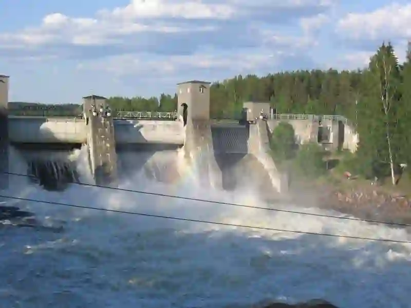
Imatra is a city in South Karelia, Finland, situated near the Vuoksa River and Lake Saimaa. Established in 1948, it has a population of around 24,000. The city is close to the Russian border, with the town of Svetogorsk just a few kilometers away. Imatra is known for its hydroelectric power plants, which are reflected in its coat of arms. The economy benefits from Russian tourism and tax-free shopping, making it a popular place for visitors.
Source: Wikipedia (CC BY-SA 4.0) and Wikidata, rewritten for RoadBreakMap.
EV chargers (44)Public toilets (26)Fuel (21)
Places
Listed with the most recorded facilities first. This is not a rating or a recommendation; always check before you travel.
- Neste
- Open 24 hours
- Neste Truck
- Open 24 hours
- ABC Imatra
- Open 24 hours
- Gasum Imatra
- Open 24 hours
- Neste D -asema
- Open 24 hours
- Neste Express Imatra CM Tietäjänkatu
- Open 24 hours
- Neste Express Imatra Koulukatu
- Open 24 hours
- Teboil D-automaatti
- Open 24 hours
- Public toilets
- Opening hours listed
- Wheelchair access
- Free
- ABC Imatrankoski
- Open 24 hours
- ABC Vuoksenniska
- Open 24 hours
- McDonald's
- Opening hours listed
- Wheelchair access
- Teboil Imatra Imatrankoski
- Open 24 hours
- Public toilets
- Wheelchair access
- Free
- Public toilets
- Wheelchair access
- Baby change
- Public toilets
- Wheelchair access
- Free
- Burger King
- Opening hours listed
- K-Lataus
- Fee applies
- Shell Imatra
- Open 24 hours
- Teboil Vuoksenniska
- Public toilets
- Free
- Public toilets
- Free
- Public toilets
- Free
- Public toilets
- Free
- Public toilets
- Open 24 hours
- Public toilets
- Open 24 hours
- ABC Imatra
- ABC Imatra
- BIG Imatra, Vuoksenniska
- Holiday Club Saimaa
- EV up to 22 kW
- Neste Ruokolahti
- Neste Truck Ruokolahti
- Plugit Kaukopään tehdas, Rantaparkki
- EV up to 17 kW
- Plugit Tainionkoski, Tainionportti
- Fast EV (50 kW)
- Plugit Tokmanni Imatra
- Fast EV (150 kW)
- Shell
- Utulan kauppa
- Rest areas
- Free
- Public toilets
- Free
- Public toilets
- Free
- Public toilets
- Free
- Public toilets
- Wheelchair access
- ABC Imatra
- EV charging
- ABC Prisma Imatra
- Fast EV (150 kW)
- ABC S-Market Ruokolahti
- EV up to 22 kW
- AP 17 - ID 20679
- EV up to 22 kW
- Eve Single Pro-Line Virta Stock
- EV up to 22 kW
- Ilmainen Laskettelukeskus FreeSki
- EV up to 11 kW
- Imatran Seudun Sähkö Oy
- EV up to 22 kW
- Imatrankosken päiväkoti
- EV up to 22 kW
- K-Lataus K-Citymarket Imatra
- Fast EV (200 kW)
- K-Lataus K-Market Lappeentie Imatra
- EV up to 11 kW
- K-Lataus K-Rauta Rautapertti
- EV up to 22 kW
- K-Lataus K-Supermarket Vuoksenniska
- EV up to 22 kW
- Kanavakatu - ID 43995
- EV up to 22 kW
- Koskenlinkki
- EV up to 22 kW
- Lidl Lidl Imatra-Vuoksenniska
- Fast EV (50 kW)
- Neste Neste Imatra Korvenkangas
- Fast EV (200 kW)
- Paloasema Imatra - ID 74947
- EV up to 22 kW
- Rajapatsaan päiväkoti - ID 74920
- EV up to 3.7 kW
Showing 60 of 99. See more on the map
Nearby: Lappeenranta Puumala Savonlinna Parikkala Heinävesi Varkaus Suomenniemi Rääkkylä Mikkeli Outokumpu Hamina Kitee
Places, opening hours and charger details come from open data and may be incomplete, out of date or wrong. Never use your phone while driving. Disclaimer & terms