Road stops in Pudong, Shanghai, China
RoadBreakMap lists 128 mapped road stops in Pudong, Shanghai, China: fuel, EV chargers, rest areas, drive-throughs and public toilets, where the data has them. Data: OpenStreetMap and Open Charge Map.
About Pudong
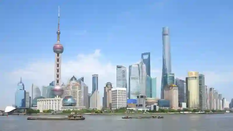
Pudong is a district in Shanghai, located on the east side of the Huangpu River. Established in 1993, it has grown into a significant area known for its modern architecture and economic activities. Pudong includes the Lujiazui Finance and Trade Zone, home to notable skyscrapers like the Oriental Pearl Tower and the Shanghai Tower. The district also features the Port of Shanghai, the Shanghai Expo, and the Shanghai Disney Resort, making it a key part of the city's development.
Source: Wikipedia (CC BY-SA 4.0) and Wikidata, rewritten for RoadBreakMap.
Places
Listed with the most recorded facilities first. This is not a rating or a recommendation; always check before you travel.
- 中国石油昕鑫加油站
- Open 24 hours
- 中国石油源深路加油站
- Public toilets
- Wheelchair access
- Baby change
- Public toilets
- Open 24 hours
- Public toilets
- Opening hours listed
- Wheelchair access
- Public toilets
- Wheelchair access
- Free
- Public toilets
- Wheelchair access
- Free
- Public toilets
- Open 24 hours
- Public toilets
- Wheelchair access
- Baby change
- Public toilets
- Wheelchair access
- Baby change
- Public toilets
- Wheelchair access
- Baby change
- Public toilets
- Open 24 hours
- Costa咖啡
- Costa咖啡
- 中国石化
- 中国石化
- 中国石油
- 公共厕所
- Opening hours listed
- 星星汽车充电站
- 特来电
- EV chargers
- Public toilets
- Wheelchair access
- Public toilets
- Opening hours listed
- Public toilets
- Public toilets
- Wheelchair access
- Public toilets
- Public toilets
- Opening hours listed
- Public toilets
- Wheelchair access
- 5号望江驿
- 6号望江驿
- 8号望江驿
- 9号望江驿
- 上海充典新能源科技有限公司充电站
- 东上海加油站
- 公共厕所
- 厕所
- EV chargers
- Fuel
- Fuel
- Fuel
- Fuel
- Fuel
- Public toilets
- Public toilets
- Public toilets
- Public toilets
- Public toilets
- Public toilets
- Public toilets
- Public toilets
- Public toilets
- Public toilets
- Public toilets
- Public toilets
- Public toilets
- Public toilets
- Public toilets
- Public toilets
- Public toilets
- Public toilets
Showing 60 of 128. See more on the map
Nearby: Yangpu Xuhui Huangpu Hongkou Shanghai Puxi Gaojing Zhabei Changning Pengpu Jing’an Songnan
Places, opening hours and charger details come from open data and may be incomplete, out of date or wrong. Never use your phone while driving. Disclaimer & terms