Road stops in Santos, Sao Paulo, Brazil
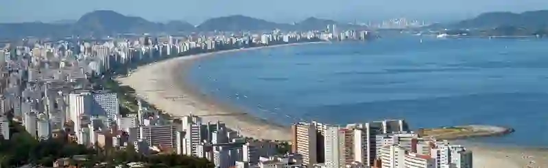
RoadBreakMap lists 37 mapped road stops in Santos, Sao Paulo, Brazil: fuel, EV chargers, rest areas, drive-throughs and public toilets, where the data has them. Data: OpenStreetMap and Open Charge Map.
About Santos
Santos is a municipality and big city located in the state of São Paulo, Brazil. Founded in 1546, it is primarily situated on the island of São Vicente, which also contains the city of São Vicente. Santos is part of the metropolitan region of Baixada Santista and has a population of 429,547. The city features a notable beachfront garden and is home to the Coffee Museum and the Port of Santos, a significant hub for trade in the country.
Source: Wikipedia (CC BY-SA 4.0) and Wikidata, rewritten for RoadBreakMap.
Places
Listed with the most recorded facilities first. This is not a rating or a recommendation; always check before you travel.
- BR
- Opening hours listed
- Auto Posto Valongo
- Shell
- Shell
- BR
- McDonald's
- Posto Anchieta
- Posto Farol
- Posto Ipiranga - Auto Posto Betmar
- Riviera Shopping Estacionamento
- Fast EV (350 kW)
- Shell
- Shell
- Public toilets
- Baby change
- Public toilets
- Free
- Public toilets
- Public toilets
- Free
- Casa do Procópio
- Espaço Bromélia
- Espaço Bromélia
- Espaço Sol e Lua
- Espaço Suiná
- Espaço Suinã
- Volvo - Pão de Açúcar - Riviera de São Lourenço, SP
- Fast EV (60 kW)
- Fuel
- Public toilets
- Public toilets
- Public toilets
- Public toilets
- Public toilets
- Public toilets
- Public toilets
- Public toilets
- Public toilets
- Public toilets
- Public toilets
- Public toilets
- Public toilets
Nearby: Guarujá Cubatão Ribeirão Pires Mogi das Cruzes São Vicente Santo André Poá Mauá Iguatemi Praia Grande Guaianases Itaquaquecetuba
Places, opening hours and charger details come from open data and may be incomplete, out of date or wrong. Never use your phone while driving. Disclaimer & terms